 A recent paper published in Nature shows a correlation between the surface temperatures of the Pacific Ocean and US east coast temperatures. The hypothesis is that sea surface temperature anomalies called the Pacific Extreme Pattern can predict east coast temperatures and rainfall up to 50 days in advance. In order to make meaningful and current predictions, this means that the data needs to be collected real time, which requires devices that can measure and transmit. This is a great example of Internet of Things thinking to be able to gather and utilize data without sampling by humans, especially in the middle of the ocean. I wondered about other weather activities that were being assisted by technology, so I did some research.
Radar
Radar has been used for many years to predict weather. Radar works by sending out radio waves that bounce off of dust, precipitation, or ice particles in the atmosphere. By measuring and comparing the strength of the signal going out and the return signal, forecasters can see the location and intensity of an oncoming storm. Simple radar, however, leaves meteorologists blind to the actual shape of an object being measured so they cannot differentiate between a raindrop and a hailstone. Dual polarization technology helps give that raindrop shape so that forecasters can better predict what is coming and what the precipitation rate will be. Another technology being tested is phased array radar. Traditional Doppler radar systems scan the skies in slices until they have scanned the entire atmosphere. This takes four to six minutes. A phased array system sends out multiple signals simultaneously and can scan the atmosphere in under a minute. This could make a big difference when providing storm warnings.
Of course, all of this probing and sampling generates large amounts of data so the meteorologist also needs to rely on his friendly information professional to sort it and create visualizations that convey the information.
Satellites
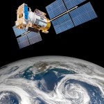
Forecasters also rely on satellites to monitor weather patterns around the globe. This provides a wider view of the weather and can predict movement with greater accuracy. A new satellite, called a Geostationary Operational Environmental Satellite R Series or GOES-R is set to launch this year on October 13. According to officials at the National Oceanic and Atmospheric Administration (NOAA), “The weather imaging capabilities of GOES-R are like going from a black and white television to HDTV.” This will expand our ability to monitor and predict weather.
Computer Modeling
Computer models are a mathematical way of predicting the future based on what has happened in the past. In terms of weather, a model can forecast actual conditions based on patterns that have already occurred. The more historical data is available, the better the potential forecast. Your friendly television meteorologist uses a combination of computer models and current weather patterns to predict tomorrow’s weather. As noted above, these models require an information professional to sort the data and eliminate anomalies that would give false predictions. Because of the large amount of past data available, some of this modeling is done on supercomputers that can process the information quickly and efficiently.
Thoughts
There are a lot of exciting developments in meteorological science and we are getting better at accurately predicting the weather and providing more lead time in front of damaging storms such as tornadoes and hurricanes. With this work we should be able to predict with better accuracy whether to leave the house with an umbrella or get to the nearest storm shelter.
Kelly Brown is an IT professional and assistant professor of practice for the UO Applied Information Management Master’s Degree Program. He writes about IT and business topics that keep him up at night.

